


The Imaginary Cartographic World in Contemporary Art 1
Art and cartography have been interwoven for a very long time, perhaps as far back as the very beginnings of cartography. Medieval T and O maps were often richly ornamented, as were the portolan charts that appeared in the 13th century;2 indeed Renaissance artists often took part in creating these maps. Today, at a time when artists have largely distanced themselves from this activity — as they have done for centuries — interest in cartography nonetheless has greatly increased in the art world since the 1970s, together with what we call conceptual art in the broad sense.3
In fact, artists are re-examining cartography procedures. They stress the problems that cartographers, in the regular exercise of their profession, stop noticing because they are too focussed on producing reliable instruments for positioning oneself in space and evaluating the distance between particular places. However over the last thirty years, geographers have taken a lively interest in cartographic activity, in what Anglo-Saxons call “mapping,” to some extent shifting their analyses more towards processes than objects.
Meanwhile, contemporary artists have considered the map, on one hand, for its pictorial and semantic complexity (Jasper Johns, Pierre Alechinsky, etc.) and on the other, as a means of “documenting” ephemeral actions and for locating hard-to-access works of certain Land Artists (Robert Smithson, Nancy Holt, Dennis Oppenheim or Richard Long), but they have done so in order to subvert it, and explore all of its possible uses.
This dual interest follows the complex nature of maps, being neither completely image nor completely concept, but rather particular kinds of images, at once concrete representations and abstract thought, icon and index. Thus, one might say, like the philosopher Nelson Goodman, that every map is “schematic, selective, conventional.” Schematic because, like the Kantian schema, which is a property of the imagination, a map is an operator situated between the image and the concept. Selective, because it depends upon a choice of size and scale, ensuring not everything can be depicted. Conventional, because it organizes a homogenous space in which one distributes names on a white surface within a rational and orthonormal frame, allowing them to be positioned precisely on the represented country. This also means that the map does not give us reality in itself but an intellectual construction always at a distance from it. As Goodman also says: “There is no such thing as a completely unabridged map; for abridgment is intrinsic to map making.” 4
Contemporary art speaks to us from this gap, and it is in this inadequacy that it will be set up. And so, we will consider this in three ways: naming, representing and tracing.
TO NAME
Any reading of maps presupposes an art of interpretation, especially that of toponyms. One notes this in consulting any atlas, and a particular virtue of the one that Wim Delvoye created is its insistence on this, although we don’t notice it immediately, since his Atlas initially seems concerned with non-existent countries and is modeled on educational works of the 1930s. This atlas, in fact, is entirely imaginary even if it includes physical and political planispheres, forty-one maps and an index of 2,715 names.5
Just as Tolkien created the names of the imaginary people and countries on the Map of Middle-Earth from diverse linguistic roots, Finnish and Semitic, for example, Wim Delvoye forged names that sound close to known toponyms or that arise out of established nomenclatures. These names also are evocative of forms that sometimes seize hold of us suddenly, revealing this animal or that object mischievously concealed in the contours of a continent or in the design of an island.
Marcel Broodthaer, who officially came to art quite late, might also come to mind. He created his first artworks only after having reached his fortieth year. His poetry practice naturally led him to investigate modes of writing that took account of the space of the book as much as the meaning of its words. The Mallarmean endeavour of the Coup de dé found a radical form in his work by eradicating the word in favour of its spatial volume, represented geometrically by bands of black. This technique, which obliterated meaning for a plastic effect, speculating on the rhythm and position of the lines thus obtained, was picked up by the Italian artist Emilio Isgrò who created, in 1970, and then again a few years later, a series of works that consisted in blackening all the toponyms on geographical maps of Italy, the Mediterranean Sea and the Caribbean Sea, titling them each time with the original map name — for example, Mar dei caraibi 1970 — and giving them all the same subtitle: Carta geografica cancellata. 6
One understands artists being tempted to begin with place names when working with maps, either by deleting them, or preserving just them, as David Renaud did when he painted over a map entitled Giverny, and emptied it of all signs, forms and colours save the names of the region inscribed on it. In this way, he obtained a kind of calligramme or “map-poem” which, as Jean-Yves Jouannais wrote, “through the litany of its toponyms suggests or underlines the conventions that construct any landscape.” 7
TO REPRESENT
In order to imagine, one needs distance between the world and the self, empty space between things, a void within the being. In the process of making an imaginary map there is a link to emptiness, and some artists have learned how to locate and render this in their efforts to map such an “in between,” a blank space, an interstice.
This takes us back to the blank spots on ancient maps, still seen in the nineteenth century, marking still unexplored zones: those white spaces that Marlow, the narrator in Joseph Conrad’s Heart of Darkness speaks of. 8 It is true that cartography can enlarge or space out territory in relation to its image or mental form. In order to exploit this tendency, members of the group Stalker, in their walks and perambulations through cities, attempt to make another city appear beneath the actual one. The maps resulting from their investigations — that of Rome, as compared to an archipelago, is the best known — are exactly what Deleuze and Guattari understand by “performance” when they oppose the map to a tracing and write that “the map has to do with performance, whereas a tracing always involves an alleged ‘competence.’” 9 This map is also made in order to lose oneself, or to shake off one’s usual relationship to the world, making interstitial territories visible, called real territories: blue for the sea, while the dense city recorded appears in yellow and resembles an archipelago.10
Robert Smithson provides a very suggestive image of this spatial parenthesis in the map of Mono Lake. In 1968, Smithson, Nancy Holt and Michael Heizer visit the West and stay in Michael’s parents’ home on Lake Tahoe. Not far from the residence is Mono Lake, an ancient salt lake sometimes called “the Dead Sea of the United States,” which lost much of its area through progressive drying. Smithson was fascinated by the landscape of limestone concretions and the unbelievable quantity of flies to be found on its banks.11 He has recounted the way in which the site seemed subject to the irresistible action of evaporation, and how the closer he got to it the more it seemed to evaporate before his eyes.
Upon returning home, he hollowed out a map of Mono Lake, retaining only a thin border, and built a container of corresponding shape that he filled with volcanic deposits, pumice stones and cold ashes from the site itself. The map is the replica of Lewis Carroll’s in the beginning of The Hunting of the Snark, in which one could see only the sea, because: “ ‘What’s the good of Mercator’s North Poles and Equators, […] Other maps are such shapes, with their islands and capes! /But we’ve got our brave Captain to thank’ /(So the crew would protest) ‘that he’s brought us the best –/ A perfect and absolute blank!’ ” 12
TO TRACE
Finally, one can consider the map as a tracing in the sense of movement and the imprint it makes on memory; in the sense, too, of the trajectory it enables or of which it takes account; and finally in terms of the kind of intensity it renders, indicating not just quantities, but qualities.
a) Maps and Memory
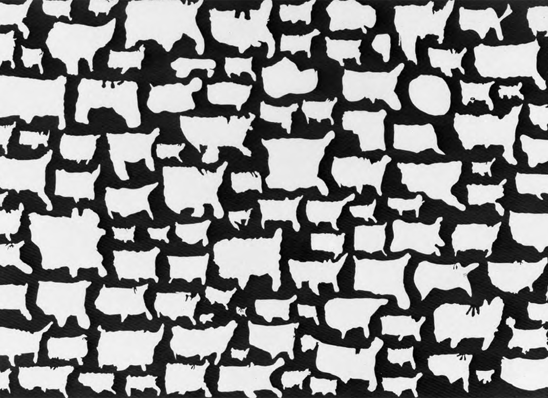
Geography professors are well acquainted with the exercise in which students draw from memory the map of a country being studied. From time to time, some sociologists also make inhabitants of a particular area draw the map of it in order to better understand what idea they have of it. Kim Dingle’s map, United Shapes of America (1991) 13—a map of the U.S. drawn by teenagers—is quite eloquent in this regard. Putting aside our more or less effective ability to draw, one doesn’t always have a very accurate idea of the proportions of the various spaces we know, or of the relationship between them.14 The distorting factors are multiple and no doubt derive from individual psychology but, on a more general level, we project onto the world a composite wholeness of forms coloured by our emotions and drawn from our memory, which superimposes a mental landscape on the real one. Sometimes, this may also be a question of collective images, as one sees in Luciano Fabro’s variations on the Italian “boot.” 15
Some artists deliberately foreground this process. For example, Pierre Joseph, an artist who recreated the map of the Parisian metro system from memory using the graphic codes of the RATP. A careful examination of the map uncovers lacunae that reveal the specific ways he uses the system, making it correspond to the routes with which he is most familiar. “I believe in collective, universal representation,” he says, “and I look for it in this game. I come as close as I can, but I exist in the gap that separates me from these models.” 16
b) Trip Maps
Artist-walkers design itineraries that are ends in themselves; they follow a route tied to the formal and poetic constraints determined by specific protocols.
For Richard Long, who for forty years has traveled the world, moving stones in order to align them or set them up in simple geometric forms, the map functions as a system of equivalences, allowing him to “fix” photographs of the landscapes he passes through within a system of coordinates. The legends on the map provide a title; tell us the time taken to cover the indicated distance or the shape of a route. Thus, Low Water Circle Walk has the subtitle: A 2 days walk around and inside a circle in highland Scotland 1980. The circle traced on the map is simultaneously abstract and concrete: its geometric form evokes the idea of a walk but each time the line meets the edge of a river or lake, it moulds a relief in the shape of the bank and reveals the geography beneath the geometry, the landscape beneath the map.
In his texts and interviews, Long emphasizes the system of traces he makes on the surface of the earth, his own like those of other walkers, those of men and animals in general. “A walk is just one more layer, a mark, laid upon the thousands of other layers of human and geographic history on the surface of the land. Maps help to show this.” 17
c) Lines of Intensity and of Rhythms
First and foremost, the construction lines in cartographic material concern forms and quantities: borders, territorial limits, the layout of road networks, orographic traces, locations of cities, etc.
One may also view cartographic lines as lines of force that indicate not only quantities, but qualities and intensities as well. In any case, artists often become interested in maps from this perspective. We find it among Native people in the north, and also in the Marshall islands, where the shell located at the centre of a bundle of twigs, caught in a reticulated structure, represents the island of the “cartographer” and the twigs themselves the movements of convergence and divergence of the waters. Reading them is complex. To simplify, let us simply say the wooden sticks represent the furrows of the waves, formed by backwash from other waves and by particular currents and the counter movement of still more waves. Here we find ourselves in the kind of vast network of furrows represented by the sea. 18
But time too is the unfolding or extension of the fold in which the expression is the very moment, and for which we find a poetic rendering in Dennis Oppenheim’s 1968 work Time Pocket. The artist dug through the snow on a frozen lake near Fort Kent, on the border between Canada and the United States, making a furrow that physically creates the configuration of the date line (IDL), also the day. This traced line is blocked by an island at the mile point and continues on the other side of it for another half-mile. Oppenheim titled this piece Time Pocket. It follows the same principle as Time Line, which plays with the convention of time zones, except here the “time pocket”—the fold or refold that fabric forms precisely when one speaks of making pockets—corresponds to an interstitial void, a moment conceived of as an internal limit of time, to take up a notion borrowed from Aristotle’s Physics.
Unlike the cartographer, the artist is not interested in measurement as such, but rather with blurring measurement. This blurring can be dynamic, think of the map as a diagram, drawing spatiotemporal multiplicities, so dynamic that it becomes a tracing of relationships of force, a seismograph of intensities, a representation of ephemeral, almost indiscernible, things. The Brazilian artist Anna Bell Geiger’s map, Mappa Mundi com Ventos, represents winds that traverse South America, isolated on the ocean, and that seem to hold an entire continent suspended, like a parenthesis at the heart of the world.
The cartographer-artist thus becomes a new Atlas, holding, as if on currents of air, the whole mass of the world he has chosen and henceforth represents. The imagination to which this map bears witness does not distance us from the real, but rather allows us to enter an artist’s vision, his way of seeing and feeling, the dynamic movement of his sentiments, the image which he recreates for us like the threshold of a dream. And so, there are maps in general that we consult by letting our mind wander and with which artists are able to guide us towards unexpected places, between two pages of an atlas where, at first glance, there is nothing to see.
Translated by Peter Dubé
Lecturer at Université Paris 1 – Sorbonne, Gilles A. Tiberghien is a member of the editorial committees of Cahiers du Musée National d’Art Moderne and Carnets du Paysage (Actes Sud/ENSP). As well as contributing to serveral collected works, he is the author of numerous publications, such as Land art; Land Art Travelling; Nature, art, paysage; La nature dans l’art sous le regard de la photographie and Paysages et jardins divers. In preparation: L’intuition de l’art (a book on the aesthetics and history of art in Italy since Croce).
-
This text takes and synthesizes some of what I wrote in my book Finis Terrae. Imaginations et imaginaires cartographiques, Paris, Bayard, 2007 and in various other texts, particularly: “Rhétorique et poétique des cartes”, L’espace Géographique, v.39, n.3, July-August 2010.
-
They were produced from the 13th to the 17th century. See the recent, very rich catalogue for the exhibition L’âge d’or des cartes marines. Quand l’Europe découvrait le monde at the National Library in Paris, edited by Catherine Hofmann, Hélène Richard et Emmanuelle Vagnon, Seuil/Bibliothèque nationale, Paris, 2012.
-
One could cite many books and exhibition catalogues on the subject, among the most recent are The Map on Art, Contemporary Artists Explore Cartography, edited by Katherine Harmon with texts by Gayle Clemens, Princeton Architectural Press, New York, 2009 and Mappamundi, Guillaume Montsaingeon, Bernardo Museum, Lisbon, 2011.
-
Nelson Goodman, Problems and Projects, Indianapolis, Hackett Publishing Co, 1972, p.15.
-
Wim Delvoye, Atlas, Michel Baverey, FRAC des pays de Loire editor, 1999.
-
See Achille Bonito Oliva, Emilio Isgrò, Compreste questa virola da emilio Isgrò, Mazzotta, 2000.
-
Jean-Yves Jouannais, David Renaud, “De la cartographie comme cartomancie”, les éditions de l’Œil, Montreuil, 2009, p.10. See also, David Renaud, Atlas, 119 jours autour du monde, Le temps qu’il fait, Paris, 2006. (translation mine)
-
“Now when I was a little chap” confides Conrad’s imaginary character “I had a passion for maps. I would look for hours at South America, or Australia, and lose myself in all the glories of exploration. At that time there were many blank spaces on the earth, and when I saw one that looked particularly inviting on a map (but they all looked that) I would put my finger on it and say, ‘When I grow up I will go there.'” , Joseph Conrad, Heart of Darkness, New York: Penguin, 1995, p.21-22.
-
Gilles Deleuze et Félix Guattari, A Thousand Plateaus, (Massumi, trans.) Minneapolis: University of Minnesota Press. 1987, p.12-13.
-
See Francesco Carreri, Walkscapes, Barcelona: Editorial Gustavo Gili SL, 2002.
-
Smithson, Nancy Holt et Michael Heizer shot a film on the site and even recorded texts for the soundtrack, but Mono Lake (1954, colour and sound) was only edited by Nancy Holt in 2004 for the exhibition Robert Smithson at the Museum of contemporary Art, Los Angeles. See also Gilles A. Thiberghien, Land art Travelling, “collection 222”, Valence, 1996, where I relate my conversation with Michel Heizer on this subject.
-
Lewis Carol, “The Hunting of the Snark”, in Alice in Wonderland: A Norton Critical Edition, New York: W.W. Norton & Co., 1992, Pp. 222-223.
-
This map is reproduced in the book You are Here. Personnal Geographies and Other Maps of Imagination, New York, Princeton Architectual Press, by Katharine Harmon, 2004, p.110.
-
Michel de Certeau, The Practice of Everyday Life, I, Berkeley: University of California Press, 2002, chapter 2.
-
There are about thirty of them with various titles: “Italia d’oro,” “it-alia,” “italia dei pupi,” “italia elastic,” “Cosa nostra,” “Italia poca seria,” etc.
-
Pierre Joseph, in GNS—Global Navigation System, Palais de Tokyo/Éditions cercle d’art, Paris, 2003, p.124.
-
Richard Long, cit. in Lucy Lippard, Overlay: Contemporary Art and the Art of Prehistory, New York, Pantheon Books, 1983, p. 129.
-
Cf. George Kish, La carte. Image des civilisations, Paris, Seuil, 1980, p.188.